

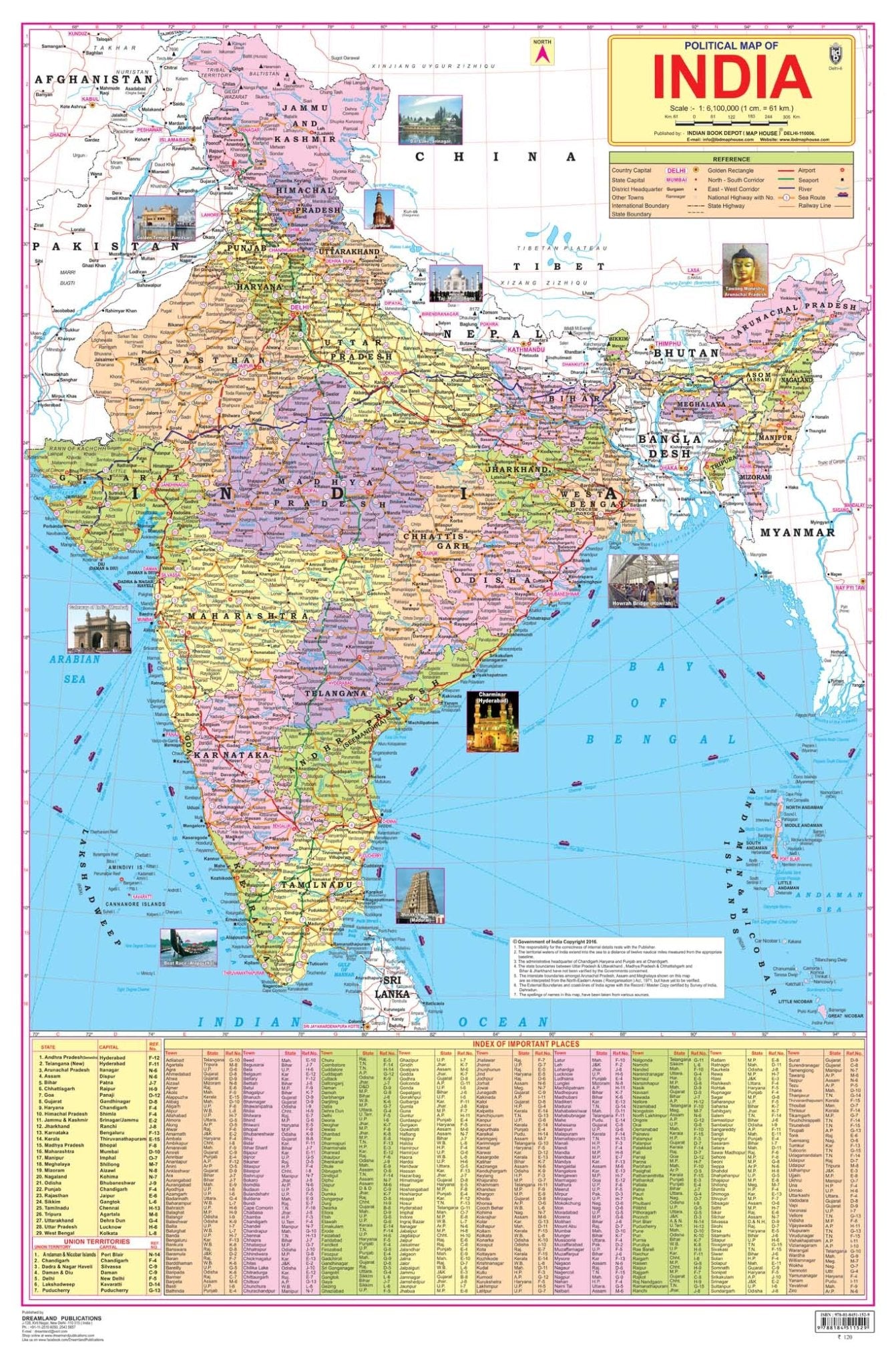
Dreamland Publications Educational Chart for Kids - India Map
Product Description
Dreamland Publications Educational Chart for Kids - India Map
India, a country in South Asia is the seventh-largest country in the world. Covering both physical and political features of the country this map shows states, UTs, and their capitals. It is a perfect wall chart for educational use, competitive exams, classrooms, teachers, and students.
- Ideal for ages 5-16
- Highly detailed
- Up-to-date
- Both side laminated
- Perfect size 48 cm (H) x 73 cm (W)
- Carton packing
- Outstanding quality
Ideal for schools, homes, offices, or any learning environment with all cartographic updates, this map is makes learning fun. It will help young geographers able to understand the symbols that show features such as rivers, roads, cities, or mountains and also know nces so that one knows how far away one thing is from another.
Legal Disclaimer:ÊProduct images are for illustrative purposes only. Images/packaging/ labels may vary from time to time due to changes made by the manufacturer's manufacturing batch and location.
Creation ID: Ê12056004
Shipping, Returns & Product Information
Product information: Product details, specifications, size/quantity and other information are provided based on information available from our suppliers and product sources.
Availability: Availability is subject to inventory and supplier availability. If an ordered product becomes unavailable, we will contact you regarding the available options.
Sourcing: Mytrendzcart sources products from established suppliers, manufacturers, distributors and other commercial sources in India.
Brand relationship: Mytrendzcart is an independent retailer. Unless specifically stated otherwise, we are not an authorized dealer, distributor or official representative of the brand shown on this product page.
Packaging: Product packaging, labels and design may change from time to time, so the product you receive may have packaging that differs from the image shown.
Shipping: Ships from Hyderabad, India. Shipping methods, estimated delivery times and applicable charges depend on your destination and are shown at checkout. See our Shipping Policy.
Duties and taxes: Customs duties and import taxes for your destination are included in the order total shown at checkout, as described in our Shipping Policy.
Returns: Eligible returns are accepted within 7 days of delivery under our Return & Refund Policy.
Customer support: support@mytrendzcart.com · +91 8885006854 (Phone / WhatsApp), Monday – Saturday, 10:00 AM – 7:00 PM IST.
Pairs well with


Why Choose Us ?
The idea behind MyTrendzCart grew from real experience with the limits of traditional business models. This inspired the creation of an independent platform where thoughtful curation, consistent quality, and genuine customer care are given priority.
Today, we remain committed to offering carefully selected products, dependable international delivery, and responsive support so customers can shop with confidence and build long-term trust with our brand.
Reliable Shopping With MyTrendzCart